
Google Maps (and others) are incredibly useful for a T2000 Poland campaign. But there’s a problem: Anachronisms.
Post Cold War Poland has been prosperous, and on a building spree, particularly since EU membership in 2004. Many things have been built that would not exist in 1996 still-Soviet-Bloc Poland: Buildings, bridges, highways.
Example: Sandomierz on the Vistula River. The bridge span on the right was built ’08-’11. So, in my Battle of Sandomierz, I blotted it out.
Google Earth has a “roll-back-time” function, but the satellite images degrade quickly the farther back you go.
EDIT: A person on social media pointed me to the Poland page at the Perry-Castañeda Library Map Collection. Wonderful resources. Most of the maps date from the Cold War, which is perfect.
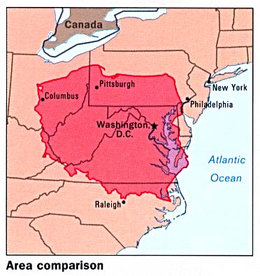
Check out this map from the site, showing Poland’s size versus the East Coast of the USA.

Does this same map collection have good maps of the former East Germany?
LikeLike
Here they are:
https://legacy.lib.utexas.edu/maps/germany.html
I see quite a bit there for East Germany. Enjoy.
LikeLike